Development Direction by Area - Area 1
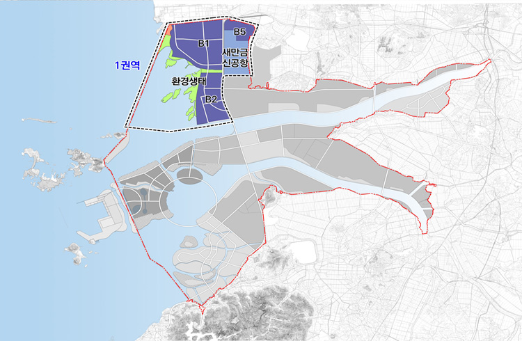

Area 1
74.4㎢
- Saemangeum Industrial Complex, Saemangeum Airport, and the surrounding area
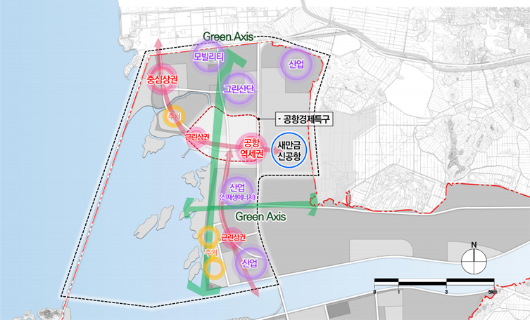
- Clustering new growth industries and research facilities, developing an innovative ecosystem associated with airport as a global innovation
Introduction Functions
High-tech manufacturing and knowledge industries, convergence and research, industrial and research support services, green hydrogen production and demonstration infrastructure, etc
Planned indicators
| Category | Unit(㎢) | Planned indicators | Remarks | |
|---|---|---|---|---|
| Planned area | ㎢ | 74.4 | Includes 32.7 ㎢ Eco Area | |
| Population and number of households | Planned population | Persons | 50,800 | |
| Planned No. of households | households | 24,200 | 2.1 person per household | |
| Schools | Elementary school | number | 5 | Around 1 per neighborhood |
| Middle and high school | number | 3 | 1-2 / small-size residential area | |
| Urban infrastructure | Neighboring facilities | Facility | 2 | Community center, Fire & police Substation |
| Park and green space | % | 20 | According to business site | |
| Infrastructure | Water supply | % | 100 | - |
| Sewage treatment | Facility | 1 | 1 facility in the area | |
| Waste treatment | Facility | 1 | Landfill, incineration | |
| Heating | Facility | 1 | 1 facility / area | |
| Gas supply | Facility | 1 | 1 facility / area | |
*A planning indicator is to set up the direction of development and the specific installation of facilities which can be adapted within the plan for the installation of large-scale infrastructure, etc. based on the project.
**Set standards of relevant laws appropriate to each development project
-
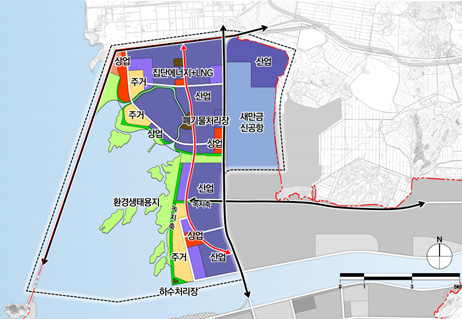
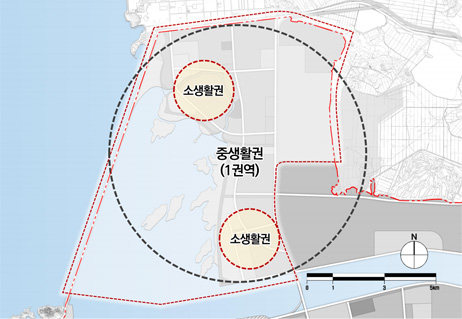
Concept map for land use planning in Area 1 -
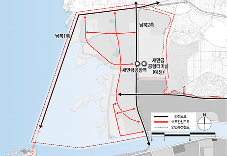
Transportation system in Area 1 -
Residential area in Area 1